Pages

Showing posts with label deglaciation. Show all posts

Wednesday, July 18, 2012

A brief introduction to... The Periglacial Environment


Great image of ice wedge polygons from physicalgeography.net

Well... not quite the post rate I'd expected after finishing Uni, but work and life take over and before you know it you've not posted anything in over a month! Before I get stuck in, I graduated last week with a 1st, something I am especially happy with as I had resigned myself to a 2:1 following an uncomfortable feeling after an exam. In other news, I’ve not seen the sun in what feels like months as Britain drowns in the longest intermittent downpour I have ever been subject to. I’m also seriously considering further study/ research; my graduation reminded me how much I miss it already! Enough about me... If I remember rightly, I promised an introduction to the periglacial environment. When I say environment in this context, I mean the specific climatic and geomorphological conditions to allow for a specific suite of processes to operate.

First, (as I'm sure @Dawnitoes will delight in reading) we'll talk about the word "periglacial". The word literally means "near a glacier" and on its inception that is exactly what the word was used for. However, since the processes and features seen in these areas surrounding glaciers were identified in other cold areas in the absence of a glacier, the term eventually evolved. “Periglacial” is now the word used to describe a set of zonal processes that occur in cold environments due to the presence of ice and snow and the repeated freezing and thawing of water. Certain azonal processes can also exhibit distinctive characteristics in periglacial areas. I've visited permafrost before in a previous article (however not formally introduced you... how rude of me). Permafrost – an area of perennially frozen ground – is responsible for many of the processes and landforms associated with periglacial areas; however it is not the defining characteristic of a periglacial area. There is likely to be an article on permafrost in the near future.

So, we have rather hand-wavey, vague explanation of the factors controlling periglacial environments without explaining any processes or resultant landforms associated with places you may term “periglacial”. Or have we? I mentioned in the paragraph above about “the repeated freezing and thawing of water”, which is probably the most important process when we consider most specific periglacial processes and landforms.

In these periglacial environments, the temperature fluctuates about the freezing point of water often diurnally (daily) at the ground surface; and annually (with the seasons) for deeper freezing and thawing. Seasonal snow accumulation and subsequent melting and the movement of groundwater towards a freezing front are also important water processes. As a general statement, these water/ ice processes result in weathering processes acting upon bare rocks and transport processes acting upon sediments.

As I write this, I’m debating whether to name and dissect specific processes and resultant landforms, or whether they warrant their own “brief introductions”... I have an idea. I’ll recommend a reference for you to read (if you wish) and then follow this up, starting with a post on periglacial weathering processes and formations, I’ll formally introduce you to permafrost, finishing with sediment movement processes and distinctive landforms. Anything I don’t catch in either of these will more than likely land in a final summary post...

For your reading, I recommend you read the following book; a comprehensive summary of the processes and landforms typical of periglacial environments:

Monday, May 14, 2012

A brief introduction to... Deglaciation

http://www.geomorph.org/wg/wgsb.html
As promised, I'm going to write today about the evolution of landscapes from glacial maximum through to interglacial. I'm particularly excited about this one because I find it really interesting. As I said in the last post, landscapes just go crazy. This post is primarily based on a leviathan of a review paper by Colin Ballantyne (2002) on paraglacial geomorphology, or the geomorphology of landscapes following ice retreat/ deglaciation.

Again, we will work with our hypothetical landscape as mentioned in the previous post. Imagine a glacier flowing down a glacial trough it has carved for itself. As air temperatures warm, the ice begins to retreat back up the valley.

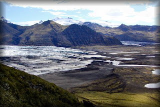
The first effect is the lack of support for the valley walls as the ice buttressing the wall is now gone. This exposes a slope that is steeper than would have naturally formed in the absence of ice. This can result in catastrophic failures of slopes or a set of discrete rockfalls to bring the slope into equilibrium with the conditions it now finds itself in. These deposits are then weathered and reworked by periglacial processes, aeolian transport and slope drainage. It is common to find gullies and debris cones superimposed upon the classic glacial trough valley walls.

An increase in meltwater from a retreating glacier will result in enhanced glacio-fluvial reworking of glacial sediments and valley floors are often in-filled with a mix of glacial till and sediments derived from the paraglacial acceleration of hillslope modification processes.

Sediment yields for such areas are thought to follow something similar to an exponential curve, with glacial and paraglacial sediments being transported by fluvial activity at a much higher rate directly following deglaciation and a gradual trend towards "background" denudation rates as the landscape tends towards equilibrium with present conditions.

Proglacial lakes - in direct contact with the glacier front - make the transition to distal lakes as the glaicer retreats away from them. The characteristics of sedimentation also change as the glacier front retreats and eventually disappears. Initially sedimentation is primarily glacigenic deposits, exhibiting features such as ice contact deltas, sub-aqueous fans and moraines, submerged ice ramps from mass movement and rythmic laminated deposits. As the glaicer retreats the pro-gradation of gently sloping deltas occurs, with the rythmic deposition of sand, silt and clay. As mentioned earlier, sediment influx decreases over time as the glacier disappears completely.

Landscape adjustment towards an equilibrium position has been estimated to take up to 25,000 years. This implies that previously glaciated landscapes during the Last Glacial Maximum c. 12,000 years ago are still in the process of rebounding to non-glacial conditions. The implications of this should not be underestimated for sediment budget calculations in populated areas downstream of relict glacial environments.

Tomorrow I hope to introduce the ice core records and their validity as an indicator of solar insolation, so don't miss that one! I find it really interesting because it is important for both reconstructing past climates through the past 800,000 years and for attempting to model future climatic changes and our place within the global system. As I said, don't miss it!